Day 2, Tonasket to Mount Rainier
We woke before daylight in a chilly RV, had breakfast by candle and flash light, and got away around 6.30.
The picture below is the view from our free spot: morning mist on the Okanogan River.
Apart from the tight quarters this is not a regular house in other ways. The toilet works, praise the Travel Gods. But the water tank is filled with antifreeze, and we cannot use the grey water line. We carry containers with clean water, and set one aside for collecting sink water. Chris had the brilliant idea of filtering the dish water, so the dirty water can be used to flush the toilet and can be dumped when needed without creating a mess. (the sink water, not the toilet)
I sort of enjoy this part. It is just the right degree of roughing it. The water-manageing skills from our tipi and log cabin years come flooding back. It becomes a sport to get clean with tiny amounts of water.
Anyway, on with the journey! Below: Verizon satellite dishes on the other side of the river a bit further South.
By the way, climate zones here run as much East-West as North-South. Eco systems have no interest in the 49th parallel. The spelling may change a bit. The B.C. Okanagan becomes Okanogan, Kootenay becomes Kootenai.
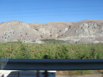
The valleys just West of the Cascade mountains are in the rain shadow and enjoy a dry sunny climate. Fruit flourishes where irrigation is possible. I love the sharp contrast between the green orchards and the bare sun-baked hills.
One would think a good picture of trees loaded with red apples would be a cinch. We passed lots of them. It was a smiley sunny apple of a day. But somehow we never passed them at the right angle or the right moment to stop. So here are some blurry apples.
Near Brewster the Okanagan joins the Columbia.

Next: Approaching Wenatchee.
For a brief moment we are on the road to Leavenworth.
Then we turn South direction Ellensburg. This stretch was pleasant forest, but not particularly photogenic from a moving car.
The Ellensburg region: a wide green plain surrounded by bare ridges. Do we have to do Freeway? Let's take the scenic route along the Yakima river! This stretch was surprisingly beautiful, the river a green ribbon in a rocky canyon. Twice we saw groups of mountain sheep across the river.
Alas, the views were to the side. That means it was hard to do good pictures from a moving car, and one can't stop everywhere. This totally does not do it justice.
Next, time to find a place to check out the household battery. We found one right by the road in Selah. Chris' diagnosis was correct, we needed a new battery. The guys installed the works while I took the opportunity to bask in the warm sun.
We made our way through the urban sprawl of Yakima on the way to road 12. Mount Adams, the local resident volcano, was visible but only vaguely. On another trip years ago, we approached Yakima from the high road at dusk on a summer day, with a full Moon rising and Mount Adams a dramatic backdrop. Alas, this was before the days of digital cameras and I have no pictures except the ones in my head. This time the few pictures I got were so useless that they were deleted later to make room for ocean.
Anyway, we were on the way to Mount Rainier national park. Route 410 branches off from route 12 and gets close to the mountain. Quite frankly, this stretch, seen above, was boring. The road climbed and climbed but there were too many trees in the way to get a good view of anything. We were wondering when we'd get glimpses of the Big One, and where we'd spend the night because it was getting late.

Finally a viewpoint. Deep and dark and gloomy and not my favorite landscape at all. I have never liked the Cascades. One needs more skill than I have to catch the sweep of the landscape here.
A few kilometers later we came across an official view point. Look up, way up! in the other direction, and there were mountain goats on the slope! Around the corner, suddenly there was The Big One. Mount Rainier in all its glory.
Mount Rainier dwarfs any mountains around it. We gawked and gasped and took piles of pictures.
Now it was definitely time to start looking for a spot for the night. We drove down 123, hoping for a side road or opening before it joined the busier 12. Hallelujah, a side road! It turned out to go to a part of the park: Longmire and Paradise. The entrance booth was closed for the night but there was a generous level parking spot just past the booth. Bingo. Home for the night. Alas, we came and left in half-dark, any pictures of this spot were low quality and were sacrificed later.
Here ends Day 2.


No comments:
Post a Comment
Comments have been set to anyone, un-moderated, and no captcha. So if you were here, wave to me? Spammers will be deleted and acquire bad karma to boot.