Showing posts with label Sweetgrass hills trip. Show all posts

Sunday, 11 December 2011

RV trip to the Sweetgrass Hills Day 4 and 5, Over and Out


We woke up in our day use-only spot to cold clear skies, but with a weather forecast predicting serious rain. The clouds were rolling in even while we did the breakfast routine.
The park rangers did come by just before we were ready to leave. We explained that we would have been happy to enrich the Province of Alberta by using an official camp site, if only they had not closed after Labour Day! They were nice about it and just told us to go forth and sin no more.
We were trying hard to do exactly that. However, the old Thing had other ideas. The back brakes were seizing up. It took Chris twenty minutes of patiently rocking back and forth before we had lift-off. Phew!
I am a born chicken, Chris is more adventurous. I did not want to be a spoilsport and held my fearful tongue. To my great relief the man himself decided to abort the plan to drive the Kananaskis road through wonderful wild country. Instead we would take 22, the more Easterly route through more inhabited country. And what was the point of driving further North if all we could see was clouds? We'll do it another time.
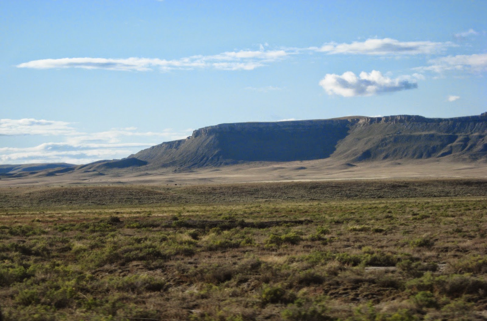
Typical landscape for route 22 not too far from Calgary. Some real bona fide ranches with lots of hobby acreages in between and the occasional monster home, see below.
I briefly dozed off, we missed the turn-off near Bragg Creek, and we accidentally found ourselves briefly on route 66 through the Elbow Valley.
Good thing Chris noticed we seemed to be going South, and what was this land doing getting wilder? It is splendid country with lots of river access, only an easy 2 hour or so drive from Calgary. Not a bad place to live at all! I cannot remember where exactly the picture above was taken but somewhere in foothills country. 
Anyway....Just for a change we drove home through Radium Hot Springs. I had hoped for a soak, but we didn't dare to park the Thing at close quarters, just in case it needed special measures to get going again. So on we went, making vague plans for a midwinter East Kootenay Hot Springs mini-vacation.
Shelter for the night was a commercial campsite on Columbia Lake.
It is owned by the local First Nations, formerly known as Indians. They have the good sense to ban jet skis from their beach, and they lease out lots to people for summer homes. Nice place with nice people. The picture was taken in the morning, notice the lake cloud.
Next: what does a mining town do when the mine closes? It goes Bavarian and turns itself into a tourist trap!
Kimberley had a bit of a sad end-0f-party September feel about it, but we could tell it would be a really nice place in season. I love the way they designed the main drag with lots of curves and plants and benches. 
This one is for Catherine the Sweet Potato Queen. Notice the doggy on the bench.
Almost home now. We took the ferry again, this time because driving the Creston/Salmo pass might require too much braking. On the way we passed by the place that produced brooms for Harry Potter.

This time I was ready for the Osprey! Only one but more visible.
We had to let all the other ferry traffic get off and do some back-rolling to get the brakes to release their death grip, but after that we made it home without further mishap.$

RV trip to the Sweetgrass Hills Day 3

Originally posted to Multiply September 21 2010


We started out on the parking lot behind the civic center in Cutbank. Not scenic, but at least we were not in anyone's way.
The night before we had noticed an RV dump site by the rest stop just around the corner, so we took the opportunity to 'dump and fill'. I feel a bit guilty for using free facilities without contributing to the local economy. Alas, the sad reality is that we have two choices: travel cheap or stay home. One of the main expenses this time was health insurance for a potential 10 days. You don't want to risk stubbing a toe in that country.
Just showing that not all farm buildings are in sad shape.
We decided to make this trip about exploring the place where plains and mountains meet. For starters we'd drive back to Browning, this time towards the mountains. A mountain landscape always looks different when you see it from the other direction. 
 The picture above and many of the ones that follow are all on the Blackfeet nation.
 Taking pictures from a moving vehicle is far from perfect. The tipi pic turned out fuzzy because it had to be taken through the side window. 


When we were driving North the plains were to our right. That made it harder to get pictures of the open spaces. It looks like we are just driving through mountains, but much of this time we could see rolling hills or open prairie on the right side.
We have seen a lot of spectacular country on our trips through Western North America. Browning, Montana to Pincher Creek, Alberta is one of the most gorgeous stretches we have seen. WOW. We took #89 to St Mary, and turned left onto #17, direction Port of Chief Mountain and on to Pincher Creek. The pictures don't come close to doing the place justice. 

We were close to the turn-off to the Road to the Sun that crosses Glacier National park from East to West. Instead of going into the mountains we remained on their Eastern flanks. Going down now...
In St Mary we succumbed to the lure of home-made pie. Nice restaurant with great-looking food, it was packed.

This lovingly restored vehicle was parked in front:
One stunning view after another.
Below: Chief Mountain from a distance.


I really have to learn to do this panoramic thing. We came to this viewpoint that had the most astonishing views all around. 


Looking down into the plains.
And looking the other way at Chief Mountain, up close and personal.

Some more beauty from the edge
Somewhere around here we crossed the border back into Canada inside the International Peace Park.".
Some real prairie. We are getting closer to Pincher Creek now. This is windmill country.
The plan was to follow the edge of the mountains as far North as Rocky Mountain House, turn West there and camp at Kootenay Plains, follow the Jasper/Banff road South and make a detour over Radium Hot Springs on the way home. All this is relatively close to home, but we always just pass it, or have seen it driving East instead of West.
With this in mind we took Highway 3 West till the junction with 22 North.
 It was getting late by the time we turned West again into Kananaskis country. Ranch and oil country with the mountains close by.
The map had promised a Provincial campsite, but when we got there it was closed for the season. We found another park a bit further on that was open.
At first we thought this was home for the night. Went for a nice walk in the gathering dusk.
We came across a number of messages that made it quite clear this was a day-use ONLY site. We drove on a bit, but there was nothing else. No commercial RV park, lots of public river access but it was all day use sites only.
So we settled in and once again postponed opening the bottle of Barefoot Pinot Grigio that had been smiling at us for days. Chris only indulges if there is zero chance that we will be asked to move.
Above: Aspen and rainbow, encountered on the walk.


RV trip to the Sweetgrass Hills Day 2

The start of Day 2: our campsite along Route 93 just South of Stryker, Montana. The road to the prairies took us along the Southern edge of Glacier National Park. Alas, there wasn't much to see.
 Just this one neat feature in a spot where Chris stopped to adjust something vehicular: a natural stone staircase with water trickling down.
Further East: mountains giving way to plains.
Never mind the mountains, we have plenty at home. As we left the mountains behind the skies cleared. 
Yeeha! Open space! This is what we came for!
We stopped in Browning in the Blackfeet territory to visit the Museum of the Plains Indians. There are no pictures because use of cameras was not allowed, but it is highly recommended.
So now we get endless pictures of Land and Sky.
The weather was changeable, with intensely alive skies.
 The town of Cutbank, with Gold Butte rising behind it. Gold Butte is the middle of the three hills.
Did I mention this place is windy? Good use is made of it.
Some more land and sky.
Farm stuff. Signs of rural decay abound. Very sad and deeply wrong, but that is another story.
The cloud-shadows across the wide landscape add texture to the rolling prairie. I can stare at it for hours, just like looking at the ocean.

The map promised tourist information in Shelby, the town closest to our hills. We managed to find it. The place was managed by a sweet old lady, so tiny that she made me feel tall. Bless her heart, she rummaged around till she found  a booklet on accesing the various buttes. It said pretty much the same things that she was telling us: "The land is all private. In order to hike one has to ask for access at the farm houses. The roads are gravel and can get pretty hairy after rain. It has been raining hard.."
 Thus informed we ventured forth to see what we could see. The picture of the Sweet Grass Hills that opens this blog was taken in this stretch driving East. Encore.
The well-laid plan was to drive East, then North,  loop around and in between the buttes, hopefully with an overnight stay and some hiking thrown in, and end up at the junction of route 343 and interstate 15, the place most often used to access the hills. Alas, this plan gang agley.
We turned North at the pathetic hamlet of Galata, onto road 343.
It was great to drive straight to the hills instead of seeing them through the side window.
The joy was short-lived. Soon the blacktop gave way to gravel.*
Now we don't mind slowing down to a crawl. It might have been OK if the weather had been drier recently, or if the vehicle had been more robust. But between washboards and potholes, driving on was no way to treat our ancient Lady of the Road. A truck born in 1982 deserves respect and loving care. She gets it. So this, alas, is as close as we came to those intriguing hills. East Butte first.
West Butte below.
We turned around and decided to see if we could at least get closer by using the Northern access road, that had some more blacktop.
Above:Decaying farm buildings near Galata.
Below:Driving direction Gold Butte again, this time coming from the West, past Oilmont.


It was the same story. The road turned to gravel quite a distance from the hills. One more, and then we turn our back on the Sweet Grass Hills.

Pictures of what what we might have seen can be found here: http://www.trailpeak.com/trail-Sweetgrass-Hills-Montana-in-MT-USA-1470
By now it was getting late. The road reminded me of the Mackenzie Highway in Northern Alberta: not tourist friendly. Two narrow lanes, no shoulder, a wicked ditch at both sides, and no sign of camp sites or parks anywhere. The message seems to be that if you don't live or work here you have no business hanging around. Go away! The map showed a campsite near Cutbank. We looped around over route 215 past a small oil town named Kevin. 
It was a surprisingly beautiful stretch of "Essence of West".

By the time we got to Cutbank it was almost dark and we were tired and hungry. Was the "rest spot" by a park the campsite or was there another one? We were getting too tired to find out and settled for a spot in the empty parking lot behind the sports centrum around the corner. See you later for day 3.