Originally posted toMultiply September 19 2010
We just had a short but sweet RV trip, joining the legion of like-minded geezers that seems to be clogging the roads in September.
I love living in the mountains, but every now and then this original flat-lander needs to see wide open sky. Last year we choose ocean, this year it was prairie. For various reasons it had to be a short trip.
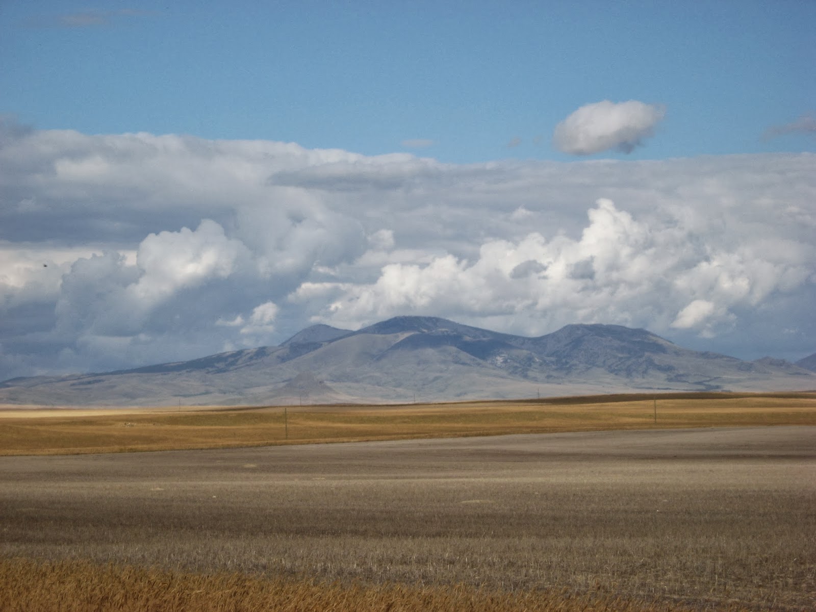
Our destination: The Sweet Grass Hills just across the border in Montana.
 The first time we saw these fascinating bumps on the horizon we had not known that they existed. This was in 1998. We were on a trip to Waterton Park (the Northern tip of Glacier National Park) and from there to the Cypress Hills. We always like driving the most remote roads, so we took 501 that skirts the border and goes through the Milk River Valley. Has anyone read Guy Vanderhaeghe's "The Last Crossing"? It is set in that region. Anyway, we stumbled upon Writing on Stone Provincial Park in Southern Alberta. A truly magical place with great views of the Sweet Grass Hills from the higher areas. Ever since we have wanted to see the hills close-up and get on top of them if possible.
 Our first campsite was just an hour from home on highway 31A, between New Denver and Kaslo. There is system in this madness: the main aim of Day Zero is to Get Away. Any distance covered is bonus. This way I am saved from the temptation to do last-minute stuff in home or garden that suddenly seems terribly urgent.
 The next morning saw us boarding the free ferry across Kootenay Lake, always a treat. This is the landing on the West Arm near Balfour.
.JPG) The ferry was packed with many motor homes among the regular traffic. Our little "Thing" is dwarfed by the big rigs.
The ferry was packed with many motor homes among the regular traffic. Our little "Thing" is dwarfed by the big rigs.
 Emerging from West Arm onto the widest part of Kootenay Lake.
 See that funny little tower thingy? There were 3 ospreys on it. Alas, I noticed them kind of late and lack the skill and the equipment to do them justice. This is just to show they were there.
 At the Southern end of Kootenay lake we find theCreston Valley. This is the one place in the Southern Interior where grains can be grown in scale. A few years ago the town looked depressed, but interesting things are happening as the Grow Local food movement gains momentum.

We just had a short but sweet RV trip, joining the legion of like-minded geezers that seems to be clogging the roads in September.
I love living in the mountains, but every now and then this original flat-lander needs to see wide open sky. Last year we choose ocean, this year it was prairie. For various reasons it had to be a short trip.
Our destination: The Sweet Grass Hills just across the border in Montana.


.JPG)


The East Kootenay region is dryer, colder and sunnier than the West. The lakes are smaller, the valleys wider. This is just past Cranbrook.
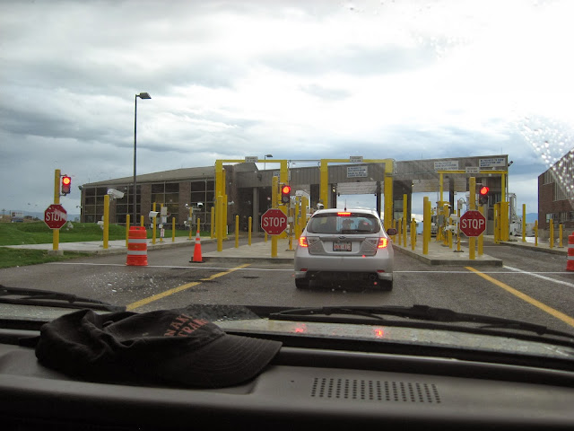 In this paranoid post-9-11 time even border crossings in the middle of nowhere have substantial buildings. Behold, the "Port of Roosville".

The border guard was actually nice and polite. I had to leave my precious home-grown tomatoes behind, but otherwise there was no problem.
Reminder to self: when planning to cross the border, do NOT stock the pantry, go shopping once you are across. You never know what will not be allowed across. In 2003 it was some smoked beef.
 The Tobacco Valley. Nice sweeping landscapes. Weather getting worse. We pulled over along the road somewhere South of Stryker and called
Reminder to self: when planning to cross the border, do NOT stock the pantry, go shopping once you are across. You never know what will not be allowed across. In 2003 it was some smoked beef.

it a day.
No comments:
Post a Comment
Comments have been set to anyone, un-moderated, and no captcha. So if you were here, wave to me? Spammers will be deleted and acquire bad karma to boot.